Search the Community
Showing results for tags 'heightfield'.
-
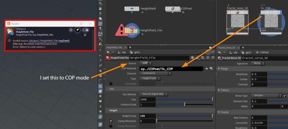
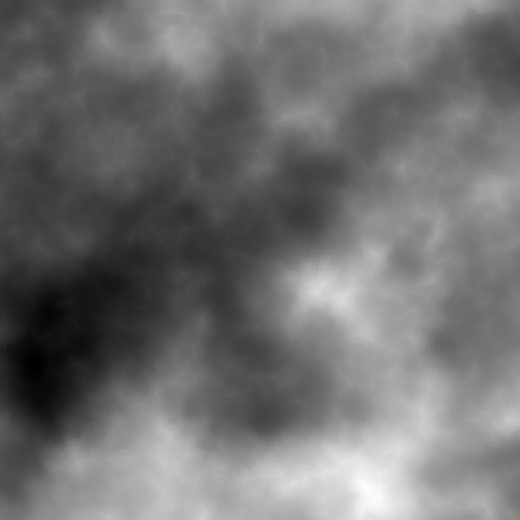
Hi guys, I'm trying to use COP noise to distort a Heightfield. I set the Source parameter of the Heightfield File SOP to COP to import my COP noise, but the setup isn’t working as expected. Am I missing something in the workflow? Or, is this the correct approach to achieve this effect? Thanks for helping. Heightfield_COP.hip
-
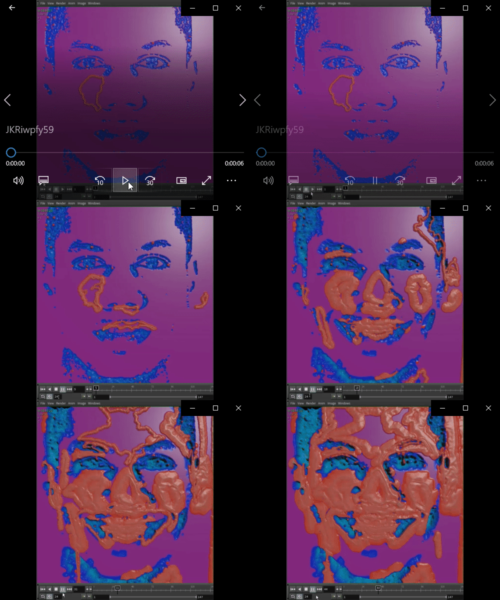
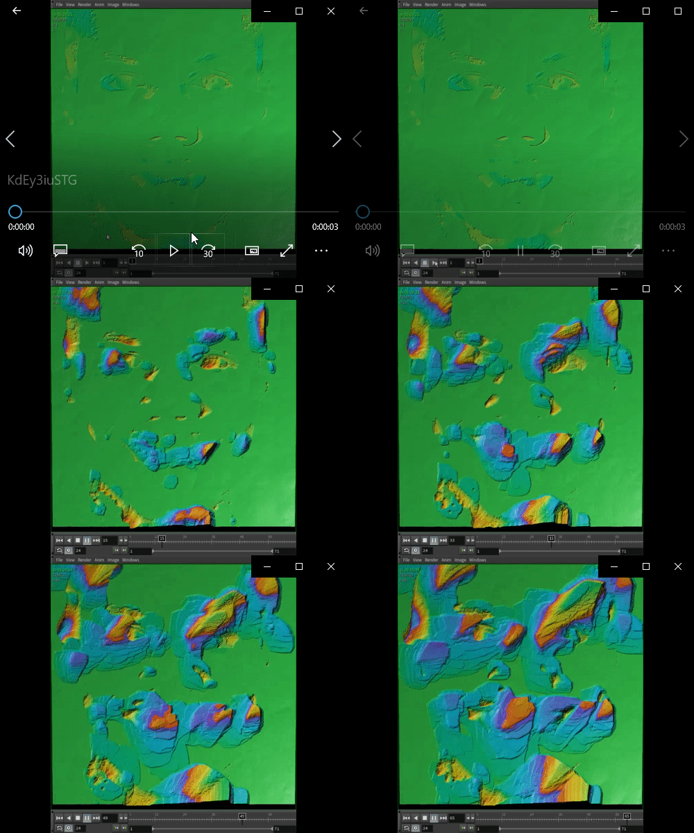
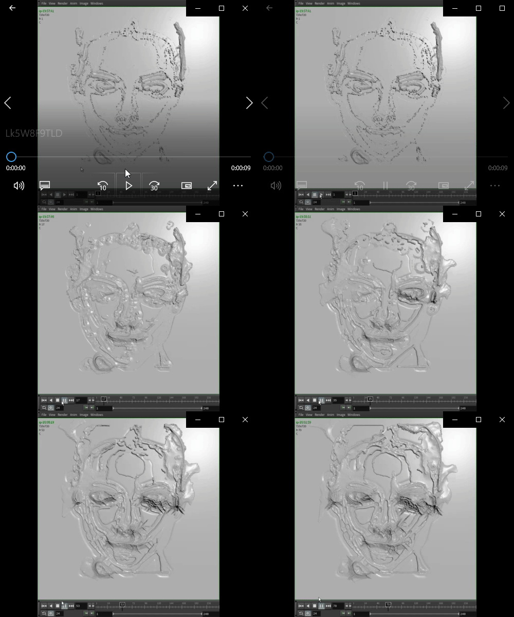
Hey guys, Been trying to wrap my head to do this cool effect by Fernando Magalhães for Future Deluxe, asked him thinking it was flip, but he told me it was heightfields, any thoughts? Here are some failed attemps I did: Any info would be great! Thanks!
- 6 replies
-
- heightfield
- painting
-
(and 2 more)
Tagged with:
-
Hey there, What approach would I take if I wanted to generate points inside a heightfield mask, where the points spread across the center of the mask? Thanks!
- 1 reply
-
- mask
- heightfield
-
(and 1 more)
Tagged with:
-
Hello, I took a tutorial on heigltfield. It does something super interesting but I really can't seem to apply it on my project. It converted to vdb to combine (ok) but when we do it at home. It gives nothing. how does he do it? Thank you and good day for all
-
How can export the flow of the water as a vector field after the erode node? i would like to import my terrain to unity and have the resulting rivers from the erosion flow using a flowmap or a volume perhaps? is it possible?
- 3 replies
-
- heightfield
- erode
-
(and 2 more)
Tagged with:
-
Hi, I'm extremely new to Houdini and I'm trying to create sand winds like in here: My approach is to create particles (sand grains) that spawn on the heightfield, before being blown by a wind simulation or something (or instead of individual grains, just a smoke simulation) What I have so far is a Procedural desert heightfield. I followed a tutorial to set up a smoke simulation that advects to a pyro,, but I'm struggling with setting up collisions and figuring out how to spawn the smoke/sand procedurally on the heightfield. My pyro sim: My heightfield: Any help would be much appreciated! I can elaborate on any part so I can get advice better.
-
Hi everyone So i built my many terrains, looking great, one was approved, cool. But when i increase the heightfield density to get the full potential of my heightfield it failed ( I started with a heightfield file generated in another process, here it's where i blend all tiles seamlessly and deform, layout, add crater impacts and so on...) So far Houdini is unable to resolve that, it cooking forever, not running out of RAM (i have 128gig) but never finished or stop... The height patch is especially heavy but even without it's failed.. Any suggestion to solve that important issue? Note that i increase the default size output limit to more than 10k as my final heightfield is larger than that. After i could split it but i first get to the point i have a seamless terrain with all my tiles to do that, which it seam impossible for Houdini to do as soon as i decrease the division size (terrain is obviously large too) Any suggestion would be welcome, thanks ! vince* ________________________________________________________________ Vincent Thomas (VFX and Art since 1998) Senior Env and Lighting artist & Houdini generalist & Creative Concepts http://fr.linkedin.com/in/vincentthomas
-
- gaea
- heightfield
-
(and 2 more)
Tagged with:
-
Im facing some weird behavior with the Sidefx erode node in the 18.5 build 452. Not about the result, but it's very capricious to cook, and i can't understand why someone it work and sometimes now. To my feeling right now it's looks more like a bug, but maybe i missed something, or lat least, i was wondering if some other people has experiment the same and found a workaround? Note im using large complex terrains... ________________________________________________________________ Vincent Thomas (VFX and Art since 1998) Senior Env and Lighting artist & Houdini generalist & Creative Concepts http://fr.linkedin.com/in/vincentthomas
- 2 replies
-
- erosion
- heightfield
-
(and 5 more)
Tagged with:
-
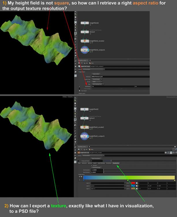
Hi guys, In "Heightfield output" node: 1) How can I export the texture created in "Heightfield Erode" visualization tab, into a (layered) PSD file format? 2) In case my heightfield not be square, how can I retrieve the right texture output resolution, based on the input heightfield aspect ratio? Thanks for helping. Terrain_01.hip
-
- heightfield
- heightfield erode
-
(and 1 more)
Tagged with:
-
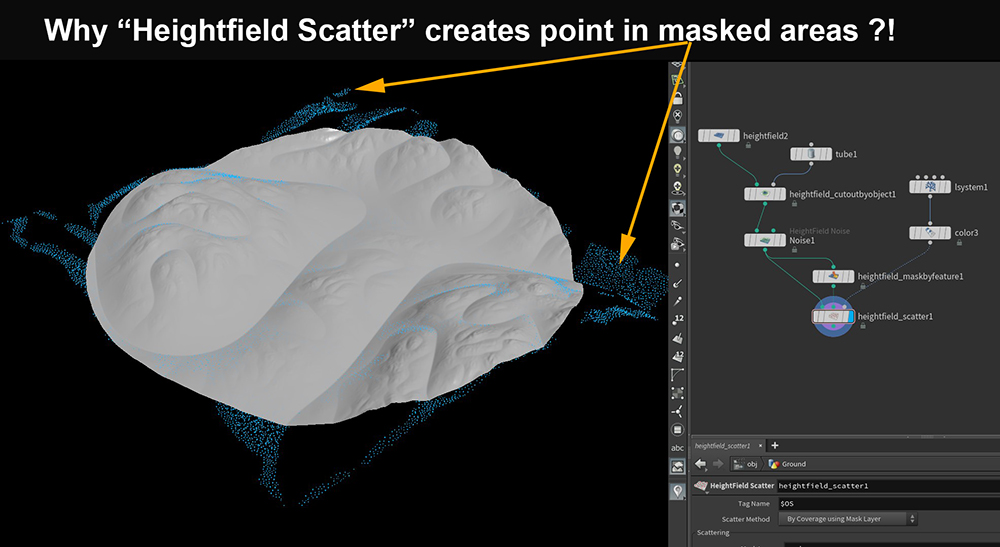
Hi guys, When I cut a Heightfield by an object, the “Heightfield Scatter” node creates points in masked areas! How can I fix this? Thanks for helping. Terrain_01.hip
- 2 replies
-
- heightfield
- mask
-
(and 1 more)
Tagged with:
-
Hey fellow Houdini artists! I'm a long time Max and Maya user and I'm now learning Houdini. I'm trying to figure out if there is a way to use heightfield paint or heightfield draw mask to store values that I can later use to affect the pscale of objects in a heightfield scatter. For example I'd like to scatter bushes on a landscape. I want each point to get a random pscale factor still...Like between 0.5 and 1.5. However, I then want to multiply that value by another masks value that I can paint. This way I could increase or decrease the general size of the pscale in the areas I've painted. This would allow me to create taller bushes in some areas or smaller bushes in other areas. This seems fairly straight forward to do with scatter, copy to points and attribute paint nodes if I'm not using heightfields. However, I'd like to do this with heightfields and heightfield scatters Is something like this possible? Thanks, Tim J
- 1 reply
-
- pscale
- heightfield
-
(and 1 more)
Tagged with:
-
Hi guys, I have a pretty straightforward question but can't seem to find a simple solution to it. I have a large heightfield grid and I want to crop a section with a Box using the heightfield_crop node. Which gives me the attached image. All great, but I would love to be able to do the inverse of this selection using the same box. That way whatever is inside the box, I can upres and the rest can stay at a lower resolution. The crop node doesn't seem to have our usual "Mix Method" options. A few things I tried was to do an extrude of the box and inverse the crop object itself but that didn't work because the bounding box stays a solid shape regardless of what's inside. Tried to convert to volumes and subtract with a volume mix, no luck either. Let me know what are your thoughts, I am pretty new to HeightFields so i might be missing a handy node that does exactly what I want. Sounds straightforward enough.. Thank you for your time.
-
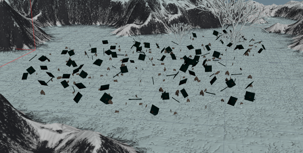
I came across a problem with heightfield scatter. The houses, that I want to copy to points are weirdly broken. Maybe it's the wrong way to create copies on the heightfield. Can you recommend a solution to this problem? cause I'm running out of ideas...Thank you! Heightfield_scatter_problem.hipnc
-
I have a heightfield as part of an HDA that is remapped. If I manually press "Compute Range" in the Heightfield Remap sop it works.... but I need to do it from an HDA processor inside Tops. I promoted the "Compute Range" parameter (button) on the HDA. It works. Then I get it inside Tops HDA Processor via the Update HDA Parameter button... BUT in there it comes as a checkbox. If I check the checkbox it does nothing. How does one enable Compute Range from inside an HDA Processor node in tops? If not, is there a way in vex to the the min and max for the voxels of the heightfield? Thanks
- 1 reply
-
- heightfield
- pdg
-
(and 1 more)
Tagged with:
-
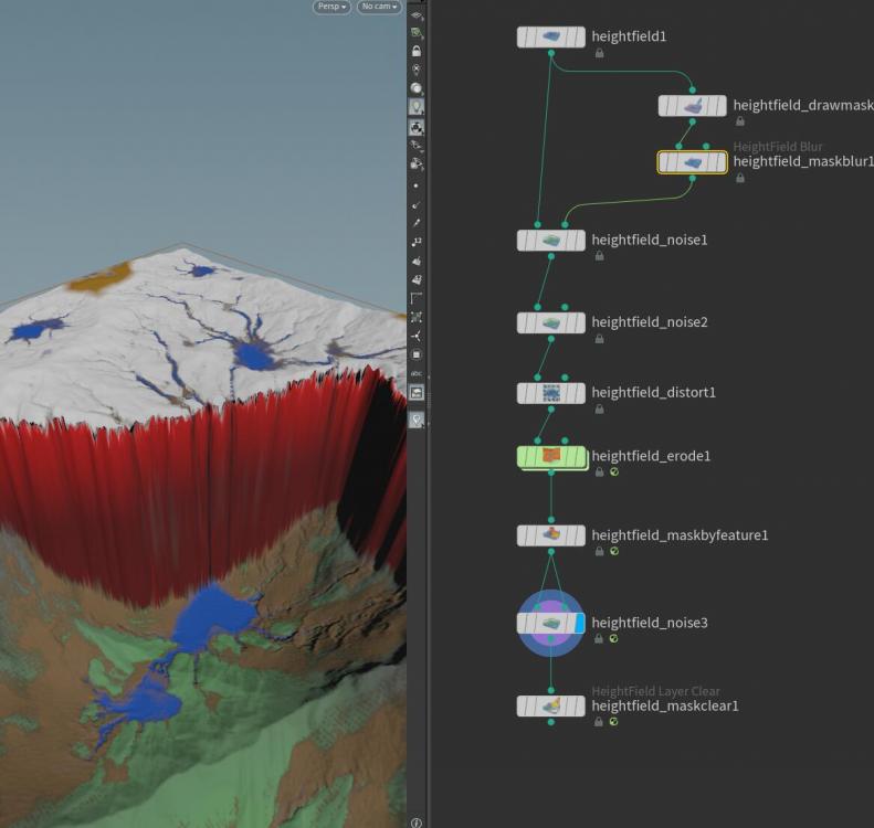
hi guys,i encounter a trouble about heightfield,i want to add detail on the verticle side of the cliff,i plug a mask and noise but it do not effect the cliff.attatch the file hip and screen shot below. may you kind would give some tips. regrads mic Terrain_Mic.hip
- 1 reply
-
- heightfield
- vertical
-
(and 1 more)
Tagged with:
-
Hi, In building a terrain, I used Entagma's tutorial on live rendering of Heightfields in Houdini using Redshift: The issue I'm running into is that my UV's are now super stretched on the terrain from using displacement on a grid. My terrain is huge, like 8,600 units across square. If I convert to polygons, it's pretty heavy. I'm trying to figure out the best workflow that will allow me to have the detail I need, but not be so polygon heavy. Would exporting out some lower resolution geo for rendering along with a baked displacement map be a good option? I need to be able to somehow edit the UVs as well so they are not stretched on my terrain texture. Any help would be appreciated. Jim
- 4 replies
-
- uv
- heightfield
-
(and 1 more)
Tagged with:
-
I'm still fairly new to houdini but with my current project I'm looking for a way to use the heightfield erode nodes layers such as bedrock or something out of a COP2 network as a mask to scatter points over (then the points used to scatter trees and rocks, etc). Had a search of the forum but couldn't find anything. Thanks!
- 1 reply
-
- heightfield
- erosion
-
(and 1 more)
Tagged with:
-
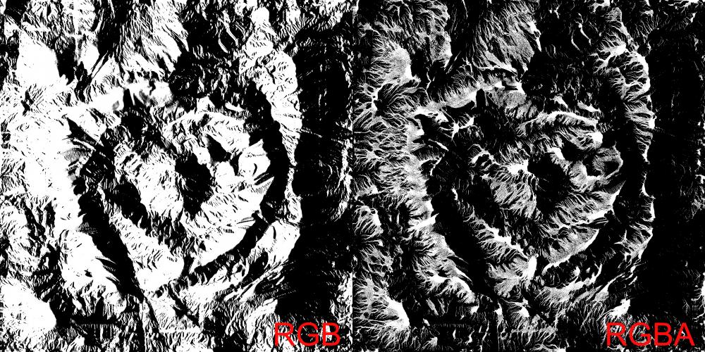
Hello, when exporting an image from the Heightfield Output node, when the .tga image is set to RGBA, the non-alpha channels are sorta polluted by the alpha. On the left, a direction mask, works fine, when exported into an 8 bit RGB tga. When I put the output node to RGBA and put something like sediments in the alpha, it affects the green channel (where the direction mask is stored), and there are no values of gray left, only pure black and white. Changing which layer is put in the alpha affects how the other three channels get polluted. Is there an option I'm missing? Is there a way to export an image in RGBA without getting unwanted results in the R, G and B channels? Thank you
-
The erosion node is the last on the network graph and every time I reopen the file everything starts recalculating. I've already frozen the erosion node on the frame I want, but I would like to store the result of the node on disc and reload it to continue from there. Any idea which node to use to cache the erosion? (up till now the terrain is a volume, not yet converted to polygons.
-
Is it possible in Houdini to export the terrain mesh in tiles?
-
Dear community, I am currently playing around with heightfields in H17 and would like to create a little island for Unreal or Unity3D. I am using the erosion filter to generate shape-features as well as water and debris masks. I really like the distribution of water areas for rivers and lakes. However, except for distributing fluid-particles around these regions and performing heavy simulations which I could bake to meshes, I am out of ideas. Especially in non-planar areas I don't know any technique that would create realistic water surfaces. For a game-engine I would usually just need the top surface parts of the water. Does anybody have an idea on how to achieve that? I am thankful for any feasible approach or idea. Best wishes, Nicolas
-
- water
- heightfield
-
(and 3 more)
Tagged with:
-
Tried to export a heightfield of a terrain in greyscale using cop2net and sop import but I get individual elements (height, water, debris, sediment...). 1. How do I get the full terrain out of it? 2. How do I even get these individual elements out? You've guessed it, I'm new to Houdini.
-
Just the default terrain of Houdini default erosion, increased resolution to 4k, exported and I get consistently (3 times) pixelated lines in the heightfield, I can see them when I import in any software (World Machine...) I attach the file and the heightfield output. Do you get the same thing? terrain exports ugly pixelated lines.hiplc

